
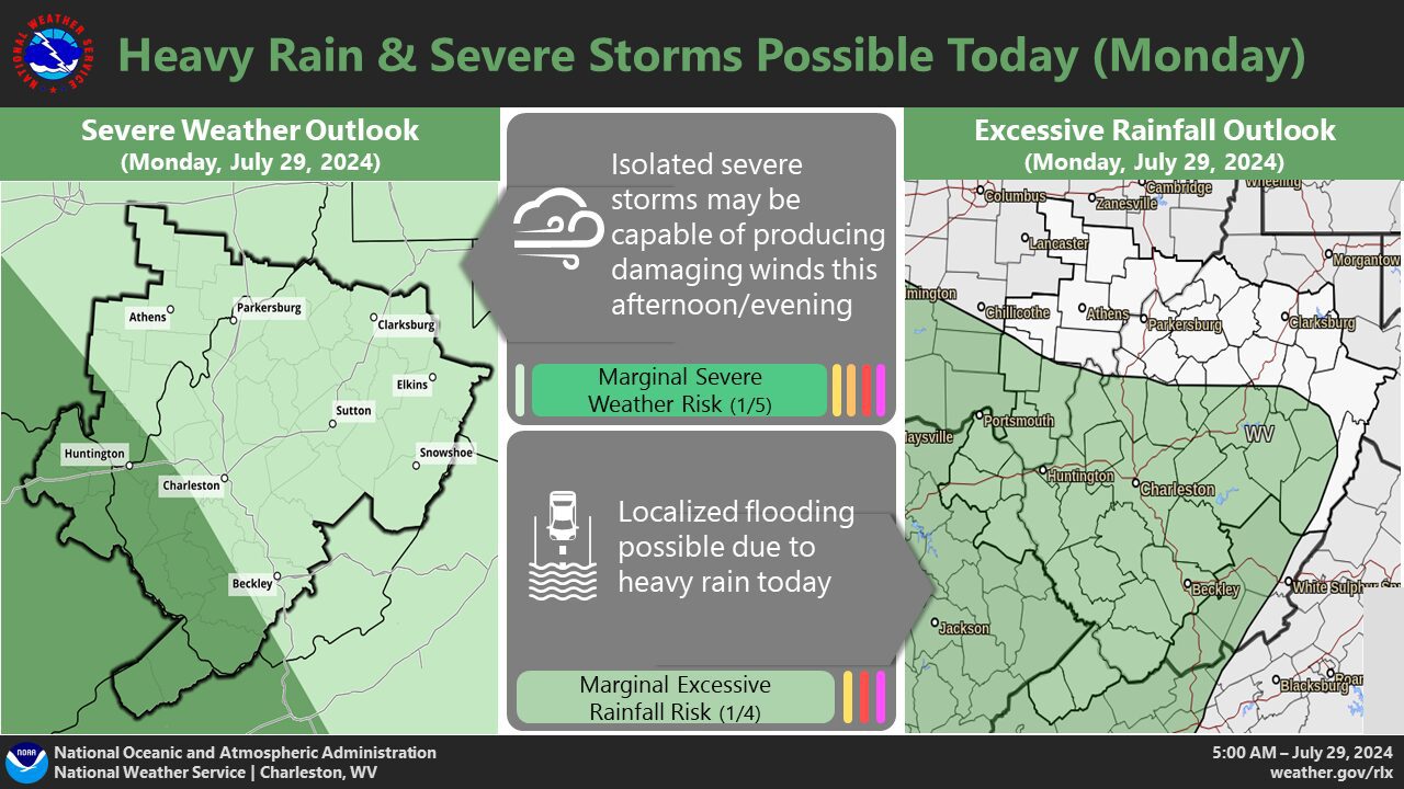
CHARLESTON, WV (LOOTPRESS) – The National Weather Service in Charleston is forecasting showers and thunderstorms due to an upper-level disturbance combined with increasing low-level moisture.
These conditions will persist into midweek, with the potential for some storms to become strong to severe, particularly in northeast Kentucky, southwest West Virginia, and southwest Virginia.
Slow-moving, heavy thunderstorms may result in localized flash flooding.
This active weather pattern is expected to provide some relief from the heat early in the week.
However, conditions may become less active later in the week, leading to warmer afternoons.
Another upper-level disturbance is anticipated toward the end of the week, which could bring additional weather activity.